Property Record
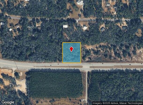
1519 E Norvell Bryant Hwy, Hernando, FL 34442

NEARBY LISTINGS FOR SALE OR LEASE
Property Detail
1519 E Norvell Bryant Hwy
Homosassa Springs, FL
Hercala Acres Unit 2
19E-18S-27-0020-00000-0440
LOT 44 OF HERCALA ACRES UNIT 2 ACCORDING TO THE PLAT THEREOF AS RECORDED IN PLAT BOOK 8 PAGES 16 THROUGH 18 OF THE PUBLIC RECORDS OF CITRUS COUNTY FLORIDA. ---&--- LESS AND EXCEPT CO RD 486 PCL 819 AS DESC IN ORDER OF TAKING IN OR 1670 PG 414 & FINAL
Commercialacreage
Citrus
AE
Florida
12017C0218D
44
2024
1.82 AC
2025
Florida Central North Area
450104
Other Market Areas
DEMOGRAPHICS near 1519 E Norvell Bryant Hwy
1 Mile
3 Mile
5 Mile
2024 Total Population
1,719
21,604
46,267
2029 Population
1,937
24,533
52,545
Pop Growth 2024-2029
+ 12.68%
+ 13.56%
+ 13.57%
Average Age
53
54
52
2024 Total Households
759
9,906
21,063
HH Growth 2024-2029
+ 12.52%
+ 13.34%
+ 13.36%
Median Household Inc
$65,827
$53,051
$46,031
Avg Household Size
2.20
2.10
2.10
2024 Avg HH Vehicles
2.00
2.00
2.00
Median Home Value
$241,749
$232,844
$212,354
Median Year Built
1993
1992
1990
Nearby Places
Map Layers
Map Styles
 Street
 Aerial
- Restaurants
- Banks
- Shops
- Fitness
- Groceries
SALE & LEASE HISTORY
LISTING DATE
SALE/LEASE

Jun 15, 2018
For Sale
Jul 06, 2022
For Sale
Nearby Properties
Address
Land Use
TOTAL SIZE
Lot Size
Zoning
Address
Land Use
TOTAL SIZE
Lot Size
Zoning
840,664 SF
6.64 AC
PDR
Address
Land Use
TOTAL SIZE
Lot Size
Zoning
114,484 SF
20.07 AC
PDR
Address
Land Use
TOTAL SIZE
Lot Size
Zoning
316,654 SF
16.13 AC
GNC
Address
Land Use
TOTAL SIZE
Lot Size
Zoning
84,611 SF
33.22 AC
PSI
Address
Land Use
TOTAL SIZE
Lot Size
Zoning
167,220 SF
9.09 AC
GNC
Address
Land Use
TOTAL SIZE
Lot Size
Zoning
300,060 SF
8.74 AC
PDR
Address
Land Use
TOTAL SIZE
Lot Size
Zoning
135,372 SF
4.58 AC
GNC
Address
Land Use
TOTAL SIZE
Lot Size
Zoning
13,025 SF
1.93 AC
PDR
Address
Land Use
TOTAL SIZE
Lot Size
Zoning
76,562 SF
212.56 AC
PDR
Address
Land Use
TOTAL SIZE
Lot Size
Zoning
67,422 SF
4.01 AC
GNC
Address
Land Use
TOTAL SIZE
Lot Size
Zoning
119,399 SF
4.77 AC
GNC
Address
Land Use
TOTAL SIZE
Lot Size
Zoning
13,577 SF
2.25 AC
PDR
Address
Land Use
TOTAL SIZE
Lot Size
Zoning
74,320 SF
4.51 AC
GNC
Address
Land Use
TOTAL SIZE
Lot Size
Zoning
16,795 SF
1.84 AC
PDR
Address
Land Use
TOTAL SIZE
Lot Size
Zoning
20,492 SF
5.02 AC
PDR
Address
Land Use
TOTAL SIZE
Lot Size
Zoning
17,496 SF
6.61 AC
PDR
Address
Land Use
TOTAL SIZE
Lot Size
Zoning
40,648 SF
4.85 AC
GNC
Address
Land Use
TOTAL SIZE
Lot Size
Zoning
18,114 SF
9.11 AC
GNC
Address
Land Use
TOTAL SIZE
Lot Size
Zoning
124,385 SF
10.16 AC
PDR
Address
Land Use
TOTAL SIZE
Lot Size
Zoning
2,088 SF
131.76 AC
PDR
Address
Land Use
TOTAL SIZE
Lot Size
Zoning
31,320 SF
5.33 AC
GNC
Address
Land Use
TOTAL SIZE
Lot Size
Zoning
151,723 SF
12.02 AC
PDR
Address
Land Use
TOTAL SIZE
Lot Size
Zoning
39,324 SF
3.48 AC
GNC
Address
Land Use
TOTAL SIZE
Lot Size
Zoning
32,361 SF
3.01 AC
GNC
Address
Land Use
TOTAL SIZE
Lot Size
Zoning
19.25 AC
PDR
Address
Land Use
TOTAL SIZE
Lot Size
Zoning
85,589 SF
6.72 AC
GNC
Address
Land Use
TOTAL SIZE
Lot Size
Zoning
42,640 SF
5.04 AC
GNC
Address
Land Use
TOTAL SIZE
Lot Size
Zoning
183,360 SF
3.42 AC
GNC
Address
Land Use
TOTAL SIZE
Lot Size
Zoning
27,692 SF
4.05 AC
PSI
Address
Land Use
TOTAL SIZE
Lot Size
Zoning
17,008 SF
5.07 AC
LDRMH
The World's #1 Commercial Real Estate Marketplace
Connect with us
© 2025 CoStar Group
The information above has been obtained from sources believed reliable. While we do not doubt its accuracy we have not verified it and make no guarantee, warranty or representation about it. It is your responsibility to independently confirm its accuracy and completeness. Any projections, opinions, assumptions, or estimates used are for example only and do not represent the current or future performance of the property. The value of this transaction to you depends on tax and other factors which should be evaluated by your tax, financial, and legal advisors. You and your advisors should conduct a careful, independent investigation of the property to determine to your satisfaction the suitability of the property for your needs.